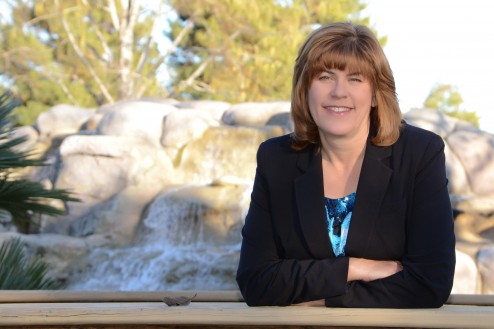
 Hi! Thanks for visiting my photoblog, and being curious enough to click on the “About” page.
I like to travel and wherever I go, I have my camera. I often drag my family and the dog out to the most remote corners of our state – from the deserts of the south to the rivers of the north. I like exploring the geography and geology of California. I am intensely interested in agriculture, and I am also very curious about infrastructure and the systems that sustain our modern society such as water and electricity.
If I take all these pictures, then I feel I need to do something with them, so I show them to you here on my photoblog.
If you would like to see the projects I have done, check out my website: www.MavensManor.com . I also publish the website, Maven’s Notebook, a California water, science and policy blog.
There’s quite a bit more information about me on the “About” page on my homepage: https://www.mavensmanor.com/about
You can also “like” Maven on Facebook, and connect with Maven on LinkedIn (Howdy, friend!)
Thanks for visiting!
Maven (aka Chris Austin)
Maven:
I just watched your “what is this place they call the delta” slide show. Superb! I lived in Davis years ago and spent a lot of time in the delta. Your slide show made me want to get back.
Please put me on your distribution list.
Thank you!
Steve Ela
Great photos and explanation of the Imperial Dam north of Yuma, AZ! It’s crazy to think that water from that dam produces almost all of the county’s winter lettuce within an hour’s drive.
We now spend our winters in the Imperial Valley and enjoyed your photos and review of the farming and irrigation projects here. My father worked for the Irrig. district for many years and was here during much of the development of the irrigation project. Thank You for sharing your work.
Hi Chris!
Love your blog and travel tales! When did you visit Rock A Hula and what route did you take from Los Angeles?
Was it really easy to just walk thru the park, without dogs or fencing?
Thank you so much for any further insights- I’d love to go!
Donovan
When we went, the place was wide open. No fence and no security of any kind. It’s obviously been completely abandoned, and probably due to its remote location, officials must not be too worried about it.
It’s located on I-15 about 10 miles past Barstow.
I didn’t realize that I didn’t embed a map, so I’m going to insert the embedded map, but here it is for your convenience:
View Rock a Hoola abandoned water park in a larger map
Have an enjoyable trip!
Thanks for the great photos of the LA Aqueduct!
Really enjoyed you blog post, images and slideshow.
Thought that the following LA Aqueduct project might be of interest to you, as it reflects upon the aqueducts impact of California…
CUMULUS: MATTHEW MOORE AND BRADEN KING
MARKING THE 100TH ANNIVERSARY OF THE LOS ANGELES AQUEDUCT
Residency: June 2013 – December 2013
Exhibition: October 5, 2013 – January 5, 2014
OPENING RECEPTION: October 5 from 7-10pm
http://grandcentralartcenter.wordpress.com/2013/09/27/cumulus-matthew-moore-and-braden-king/
This website is exactly what iv’e been wanting to see for days now. I’ve been doing research on William Franklin Holt, the Imperial Valley, and towns my cousin helped develop.your photo’s and story about the water canals are excellent! Thanks
Hi Maven, I came across your blog when searching for photos of Locke. I’m volunteering to redo their official website however there is a huge lack of good documentation. Do you think its possible to use a few of your photos? Of course we would credit you. Thanks,Angie
Love the pictures so sad, loved that place
Hi Maven,
Thanks for your photos along the aqueduct path. They are very good, especially the ones with clouds and water. You might be interested to know that the long out of print Final Report of the Aqueduct Construction is available as a free PDF download on Google Books. Also, the DWP main office on Hope street also has a little museum of the aqueduct in the lobby.
Regards,
Bob Rutledge
Hi Maven –
Thanks for the trip down memory lane w/ the photos/history of Lake Delores/Rock a Hoola. As a kid, we used to go to Lake Delores in the late 70’s/early 80’s. You had to sign a waiver to get into the park stating you wouldn’t sue the owners if you died there. Tells you a little something about the risk factor. We loved that place and all its craziness.
Cheers,
Rocky V.
Having lived in both California and Ontario, hitch-hiked in both, and having done quite a bit of farm labour in Ontario, I was delighted by your blog on Ontario farms. You pin-pointed the essential difference: most Ontario agriculture individual, not corporate. The area you picked is about average, by no means the richest farmland. At the other end of the scale, there is a considerable amount of scruffy farmland on marginal land that should have remained bush country. But if you really want to see an idyllic farmscape, you should visit Quebec, where the farms are spotlessly clean and run with stubborn pride. This image, taken in the beautiful Charlevoix region, will give you an idea of the rural Quebec ethos:
http://ekladata.com/-r2aOfXmLLziS1KEhG2VbrYPPd8.jpg
Fantastic pictures of the All American Canal, largest irrigation canal in the world! My husband and I lived in housing about 1/2 mile from the Dam for 16 years. My husband worked for the Imperial Irrigation District and the Bureau of Reclamation who jointly operate the Dam.
Great pictures of old Lake Dolores near Barstow. What a nostalgic place it is.